
QFabric.
A multi-task change detection dataset for understanding how cities grow, decay, and reshape themselves from space.
QFabric is the first labeled dataset for multi-task urban change detection: it combines change-type classification, change-status tracking, and neighborhood context across a multi-date, high-resolution satellite record.
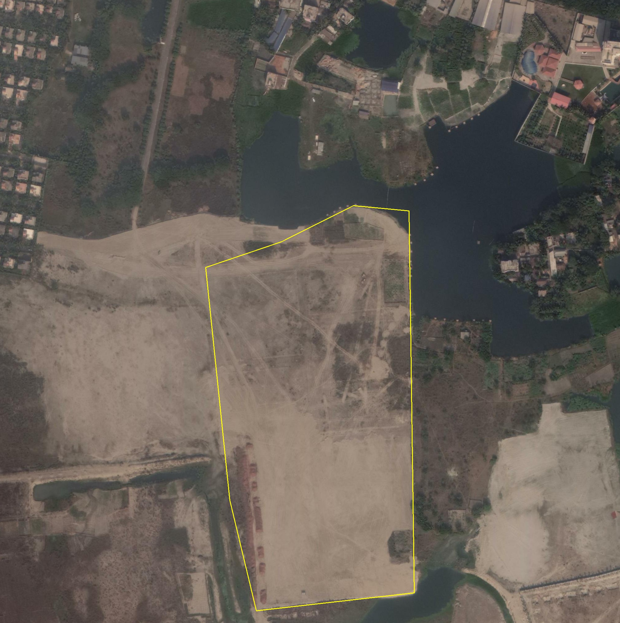
We annotate 450,000 change polygons across 504 locations in 100 cities, using five-date WorldView-2 imagery between January 2014 and July 2020. Each polygon carries one of six change types and a sequence of nine change-status labels, embedded in geography and urban metadata that lets models reason about where change happens, not just that it happened.
Change type · 6
- Residential
- Commercial
- Industrial
- Road
- Demolition
- Mega Project
Change status · 9
- Prior Construction
- Greenland
- Land Cleared
- Excavation
- Materials Dumped
- Construction Started
- Construction Midway
- Construction Done
- Operational
Context labels
- Urban type · 5
- Geography type · 11
- City + lat/lon
- Neighborhood bbox
- Per-date imagery
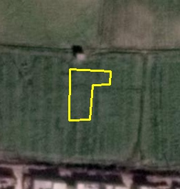
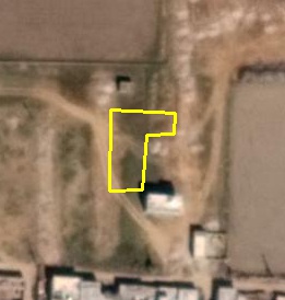
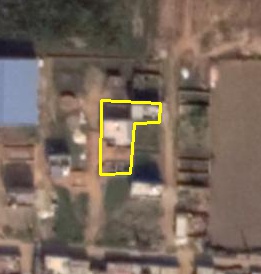
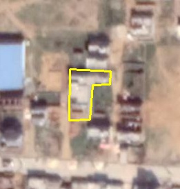
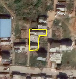
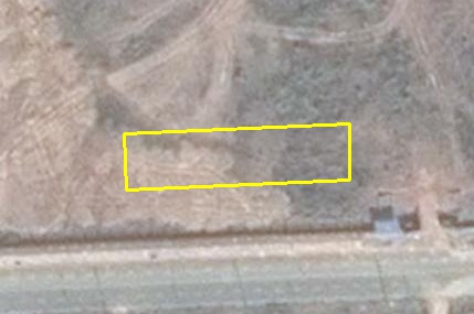
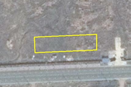
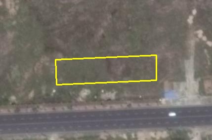
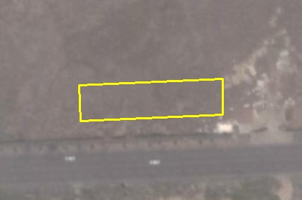
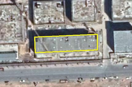
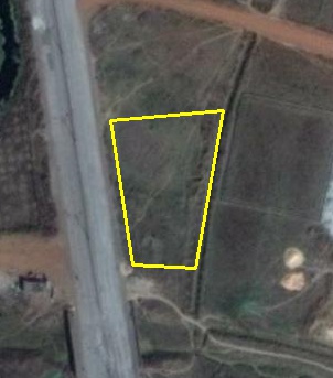
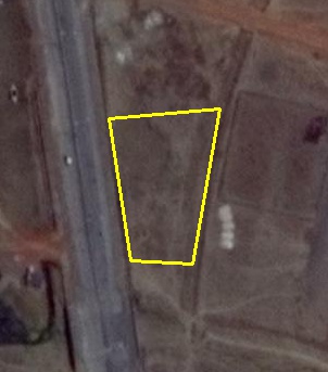
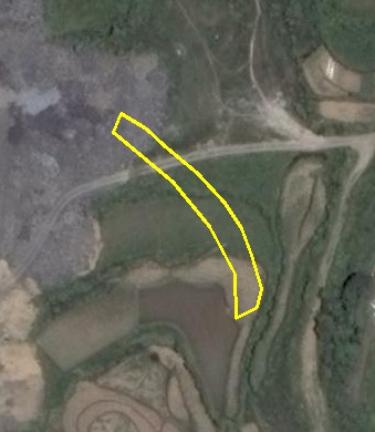
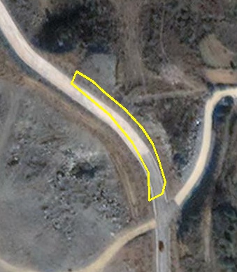
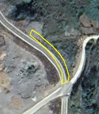
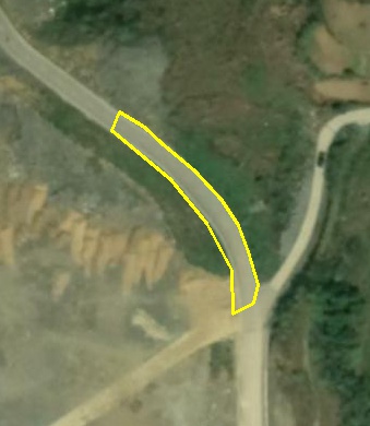
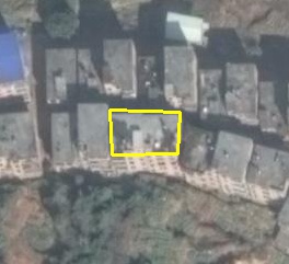
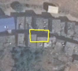
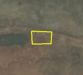
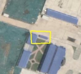
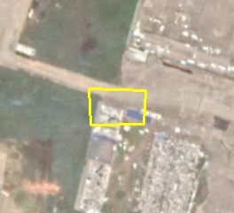
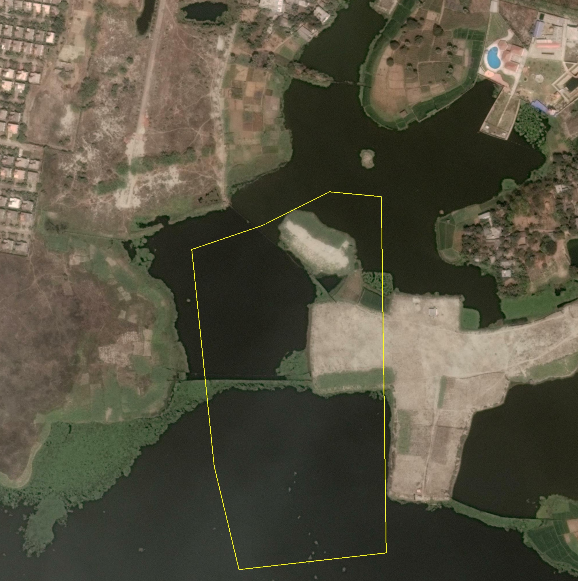
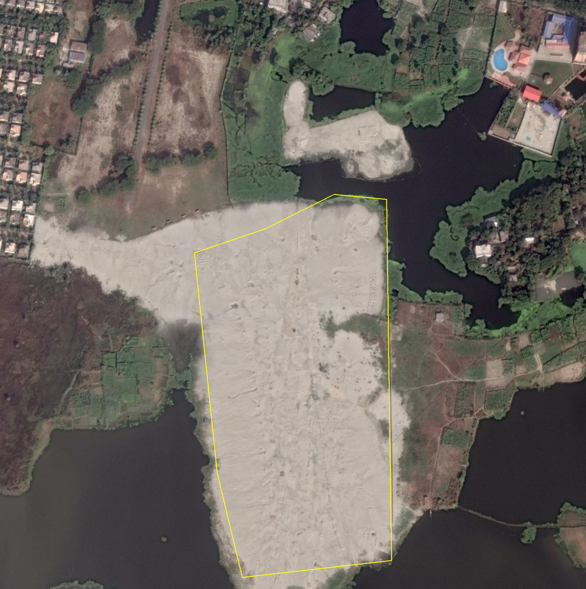
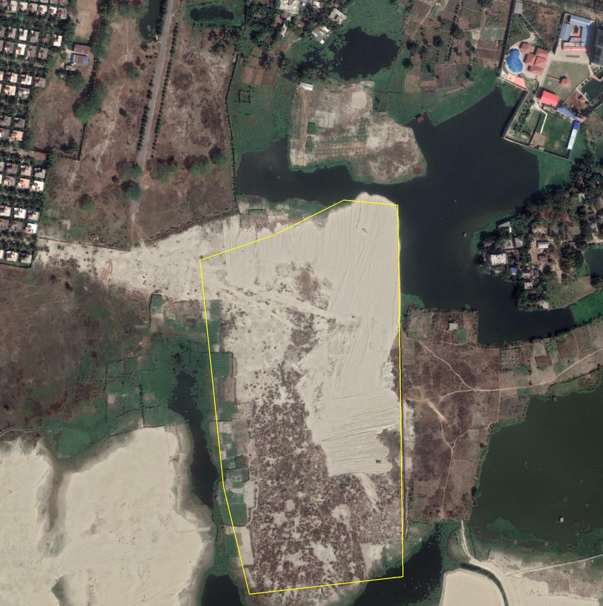
Six change types, each tracked across five dates spanning roughly 5–7 years. The polygon under observation evolves from greenland or land cleared through construction stages to operational — or, for demolition, in reverse.
Residential
Commercial
Industrial
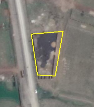
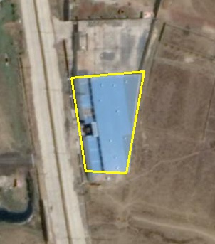
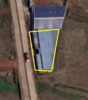
Road
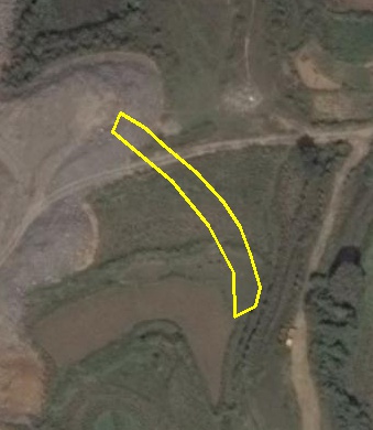
Demolition
Mega Project

QFabric is distributed as a gated dataset on Hugging Face. Request access there — the request form (name, affiliation, intended use) is built in, and each request is reviewed manually.
Access supports academic and non-commercial research. For commercial use or bulk transfer, email hello@labaerien.com.
Request access on Hugging Face ↗from datasets import load_dataset
ds = load_dataset("labaerien/qfabric")
Authenticate first with huggingface-cli login using the account that was granted access.
If QFabric is useful in your work, please cite:
@inproceedings{verma2021qfabric,
  title     = {QFabric: Multi-Task Change Detection Dataset},
  author    = {Verma, Sagar and Panigrahi, Akash and Gupta, Siddharth},
  booktitle = {EARTHVISION 2021 Workshop, CVPR},
  year      = {2021},
  url       = {https://openaccess.thecvf.com/content/CVPR2021W/EarthVision/papers/Verma_QFabric_Multi-Task_Change_Detection_Dataset_CVPRW_2021_paper.pdf}
}
QFabric is the first in a planned series of datasets and papers on urban change detection and analysis, working from the satellite scale down to the drone scale.